Why River Bends Keep Moving Across a Floodplain
Why river bends keep moving across a floodplain: follow a hypothetical Southern river to see how shifting channels reveal banks, deposits and old routes.
The common mistake with a wandering river is to treat every bend as a fixed feature on the map. That can make an old channel look like a present-day route and hide the floodplain’s story beneath a tidy blue line. Why river bends keep moving across a floodplain becomes clearer when you follow the changing water, bank by bank.
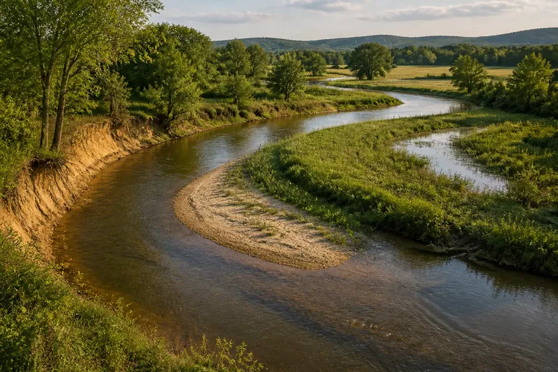
Imagine a small Southern river, the invented Cedar Run, crossing a broad, low-lying floodplain. Its current channel loops past a wooded bank, skirts a field and curls around a shallow backwater. No flood or single dramatic event is needed to set the pattern in motion: the river’s ordinary flow keeps redistributing water and sediment, and the bends respond.
Why river bends move begins with uneven flow
A river does not move at the same speed from bank to bank. Around a bend, water tends to sweep more strongly along the outside curve, where the channel is deeper and the current presses against the bank. On the inside curve, slower water can drop some of its carried sand and silt.
That contrast gradually changes the channel’s shape. The outer bank may be undercut, slump or lose soil after repeated high flows; deposits on the inner bank can form a shallow bar. As one side retreats and the other builds outward, the bend shifts across the floodplain and may grow more pronounced.
Vegetation complicates the picture without cancelling it. Roots can hold some bank material together, while fallen branches or dense growth may redirect local flow. A bend’s position reflects an ongoing balance among current, sediment, bank material and floodplain plants, not a simple rule that every curve migrates at the same pace.
Cedar Run’s bends leave clues on the ground
At the start of the imagined walk, Cedar Run’s outer banks are steep and exposed in a few places. The inner sides of several curves have low, gently sloping deposits. These differences give a reader clues about where water has been working hardest and where it has been laying material down.
Suppose the observer returns after a season of ordinary flows and sees a fresh notch in one outer bank, with a small tongue of sand extending from the inside of the same bend. That is an invented observation, not a report of a real river. The expected visible result is a slightly altered curve: a little land lost on the outside, a little added on the inside.
With repeated changes, the bend can travel sideways or extend into a wider loop. The channel may also shift its deepest current within the curve, so a bank that seems quiet from one vantage point can still be exposed to stronger flow at another stage. A single visit captures a position, not the whole process.
Floodwater spreads the river’s story beyond its banks
A floodplain is not merely empty land beside a river. When water spills beyond the channel, it can slow, spread and leave fine sediment across low ground. The deposit may be barely noticeable in a single episode, yet repeated overflows help shape the surface and connect the active channel to its wider valley.
On Cedar Run, imagine water spreading across a low field during a high-flow period, then draining back towards the channel. The action leaves a thin layer of silt in some places and small, shallow channels in others. The expected result is a patchwork: subtly raised deposits near parts of the river, lower wet ground elsewhere, and traces of flow that do not match the present channel’s outline.
Those details can help explain why a floodplain looks uneven even where it appears broadly flat. A former channel may have carried water across ground now occupied by grass or trees. A shallow depression may hold water after rain because it lies along an old route or a low drainage path, though the shape alone does not establish exactly when or how it formed.
Old channels can preserve earlier river routes
When a bend becomes especially tight, a river may eventually take a shorter route across the narrow neck, leaving the loop partly or wholly disconnected. The abandoned curve can remain as a crescent-shaped pond, a damp hollow or a line of different vegetation. Such features are often called oxbow lakes or meander scars, depending on their form and how much water remains.
For the imagined Cedar Run, picture a later shift that leaves a curved wetland beside the active channel. The starting point is a looping bend; the action is gradual change followed by flow through a shorter route; the expected observable result is a crescent of water or wet ground separated from the main river. This scenario illustrates a possibility, not a prediction that any particular bend will be cut off.
An old curve can reveal more than a past channel location. Its shape may show the direction in which the river once looped, while its position relative to the current bank suggests how the floodplain has changed. Nearby ridges, depressions and vegetation differences add context, but no single mark should be treated as a complete account on its own.
Reading a changing river without overclaiming
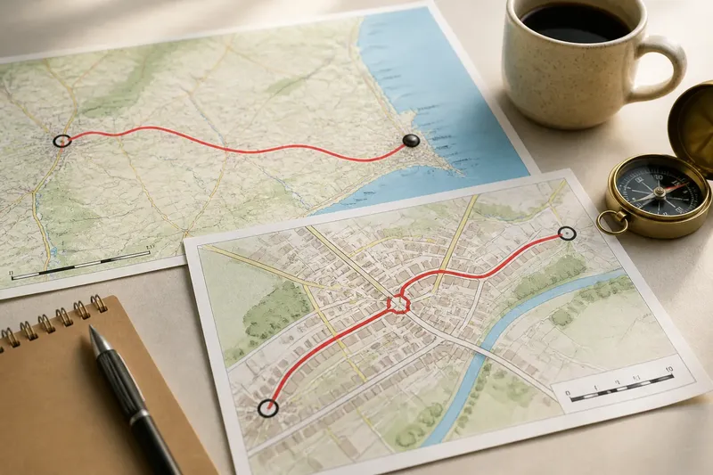
Maps and aerial images can help compare channel positions, but their dates, scale and visible conditions matter. Aerial photographs may show a bend clearly in one season and partly conceal it in another, when leaves, shadows or water levels differ. A map’s blue line is a useful representation, not a promise that the channel has stayed put.
For a careful reading of Cedar Run, the observer would compare the active channel with visible floodplain features: outer-bank cuts, inner-bank deposits, curved wetlands and shallow drainage lines. The point is not to assign a precise age or rate from appearance alone. It is to notice relationships and distinguish the current route from traces of earlier ones.
It is not worth trying to infer a bend’s exact future from one photograph, nor to treat every crescent-shaped pond as an abandoned river loop. Similar shapes can have different origins, and vegetation can disguise the ground beneath it. A cautious description—“a curved wet area beside the channel”—is sometimes more accurate than a confident label.
What can a shifting bend tell you?
Why does the outside of a river bend often erode?
Water commonly moves more forcefully along the outer curve, pressing against the bank and carrying away loosened material. Local channel shape, bank composition and vegetation affect how visible that erosion becomes.
Why does sediment collect on the inside of a bend?
Flow often slows along the inner curve, giving some carried sand and silt a chance to settle. These deposits can form shallow bars that gradually change the channel’s cross-section.
Can an old river bend still affect the floodplain?
Yes. A former channel may remain as a wet depression or drainage path, influencing where water collects even after the main river has shifted away. Its present appearance may be altered by plants, farming or later flows.
Does a shifting river bend mean the whole floodplain is moving?
Not necessarily. A bend can migrate within a broader floodplain while the valley remains in place, and different reaches can behave differently. The pattern is best read from several clues rather than one curved bank.
The floodplain keeps more than one river in view
At the end of the imagined Cedar Run walk, the river is not just a blue curve on a map. Its outer cuts point to places where flow has pressed against land; inner deposits mark places where material has settled; wet crescents and shallow hollows preserve hints of routes no longer active. Together, those features make the floodplain legible as a surface shaped over time.
That is the useful lesson in why river bends keep moving across a floodplain: the current channel is only the latest line in a broader record. When you look at a bend, look beyond its edge too. The low ground beside it may show where the river has travelled, where water still gathers, and how the next ordinary flow could continue reshaping the scene.